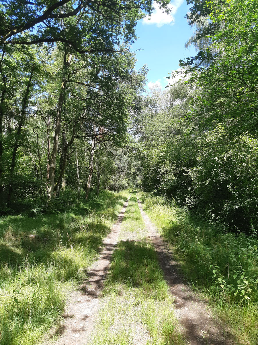
The Forest
Between Mionnay and Ambérieux-en-Dombes is a wooded area of about 800 ha more or less fragmented, which are the last vestiges in the south-west part of the Dombes of the original forest that covered it initially. This wooded area constitutes a biological corridor linking the western and southern ridges of the Dombes.
Context
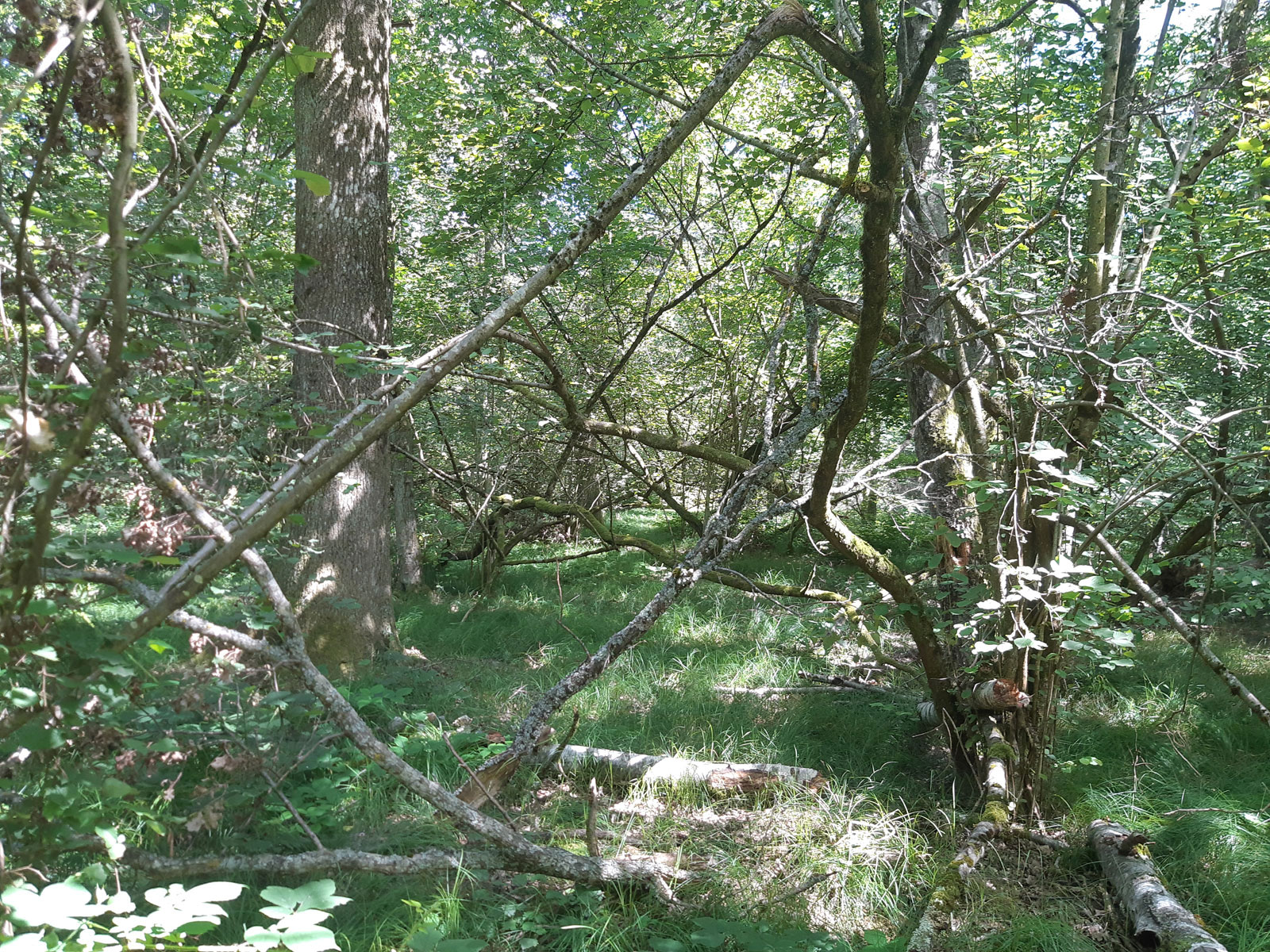
Due to the presence of numerous fallow deers (Dama dama) (more than 450 individuals in 1992 over 148 ha) within the fenced park of the Foundation and its 100 ha of forest, it had been decided to let the herd and the forest evolve naturally as long as the fallow deer population remained high. Since 1998, with the reduction of the fallow deer herd (less than 70 individuals before the 2007 births), around 30 ha of wooded fenced land had been separated from the animals, thus permitting the regeneration of 5 ha of forested land that had been cut in 1992.
The difference in treatement between the 2 wooded zones with and without fallow deer has been studied from a comparative point of view for ornithological and entomological purposes.
In 2020, it was decided to eradicate the fallow deer population, and to replace it with deers (Capreolus capreolus), the only cervid species naturally present in the Dombes. Originating from two localities (Territoire d’Etude et d’Expérimentation de Trois Fontaines (51) and Réserve Biologique Intégrale de Chizé (79)), 9 individuals have been released into the park, all fitted with GPS collars permitting to study the spatial range of all. The objective is now to maintain a population at a reasonable density, which will allow eventually to compare our forest with other freely evolving, non-fenced (and thus submitted to predation).
The Forest lots
Representing a total area of 170 ha, the forest of the Foundation Pierre Vérots is composed mainly of ancient undergrowth coppices with a dominance of European oak (Quercus robur).
This type of woodlot covers 115 ha in the Bois des Allées, the Bois du Grand Champ and the Forêt des Oies.
The woodlots belong to a group of habitats of continental meso-neutrophilic to meso-acidophilic oak stands with Carex brizoides (C.B. 41.24) characterised:
The other forest spaces are composed of aspen woodlots (Bois Renaud for about 10 ha), of aspen/oak mixed woodlots (Bois brûlé for about 35 ha) and birch woodlots (Vernange, for about 10ha).
Management and Knowledge
All in all around 125 ha of wooded Foundation land (of which 100 ha are fenced) are evolving freely in order to favour biodiversity.
Since 2010, the Foundation has adhered to the regional network of freely evolving forests (FRENE) for 117 ha of wooded lots perpetuating the management choice made for several years. Its Simple Forest Management Plan (PSGF) decided upon in 2010 and modified in 2020 for a duration of 15 ans also plans the management of a 35 ha forest acquired in 2008 (Bois brulé) with improvement cuts planned to obtain an irregular woodland, favouring the elimination of the American Red Oak (Quercus rubra).
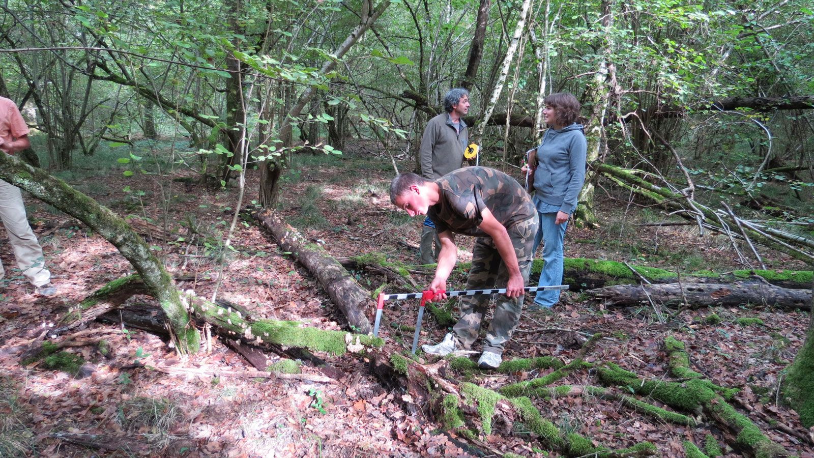
To improve our knowledge of this forest and in order to better characterise it, several Potential Biodiversity Indices (IBP) for 2 1ha lots have been realised by the CRPF (Bois Brûlé and Bois des Allées) and 10 lots by the REFORA (within the fenced park and and in the Forêt des Oies). These records have permitted to obtain an inventory of our forests at the beginning of its integration in the regional network of freely evolving forests; forest that had been mapped in 1987 by the National Office of Forests (ONF).
Finally, in 2017, the Foundation has commissioned the study firm LATITUDE to harvest data (forest and phytosociological) in order to study the links between vegetation structure of woodlots and the structure of bird populations on the Foundation domain. This study will permit also to study and understand the evolution of a forest without management, by comparing the data obtained with those that will be obtained in the future.